Matlock to Oker Hill Circular Walk
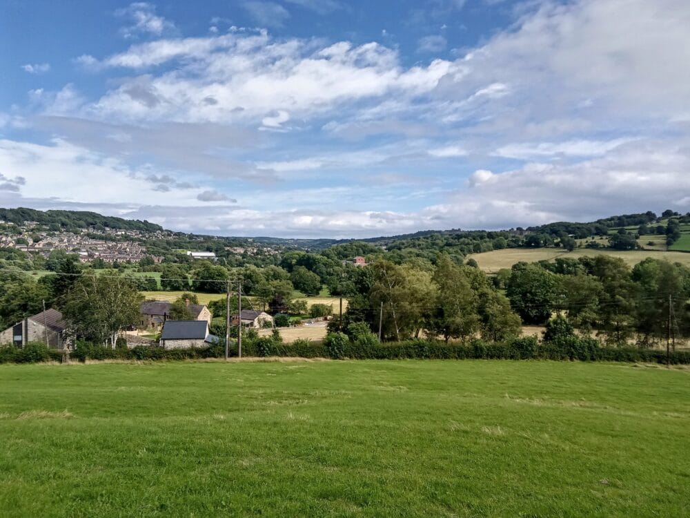
The ascent of Oker Hill provides great views over Matlock and Darley Dale. The ascent of Oaker Hill is a little steep, otherwise this walk is fairly easy.
From Matlock station, head towards the town centre. Cross at the pedestrian crossing and take the pavement leading down to the riverside footpath. (N.B. This is a slight variation to the start of the walk from the Derbyshire Dales booklet, which gives directions from Crown Square).
Follow the path alongside the river, passing under the road and railway bridges and a factory until you reach pleasant open fields. Continue ahead when you reach a junction with a farm track and a metal farm gate on your right. Go over a stile where the path is rejoined with the riverbank.
You will see a fork in the unsurfaced path here. You need to go left – diagonally across the field to reach a stile and a fingerpost. Go over the stile and turn right to follow the lane keeping on the right hand side of the road. Take care – watch out for traffic.
In about 150 yards you need to turn right into Aston Lane. On you left you’ll see a stile by a fingerpost. Go over the stile and head up the field, bearing right. There is no obvious path across the field but when you reach the trees (and a thicket of hawthorns) you should be able to pick out the path which leads up through the wood to some steps and a stile. Go over the stile and turn right. Bear left and immediately head up the bank through the gorse. At the top (by a waymark post) turn right and walk along the top of the ridge.
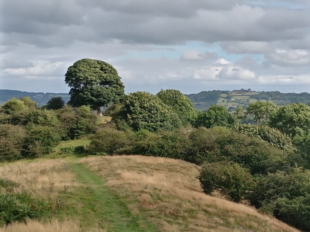
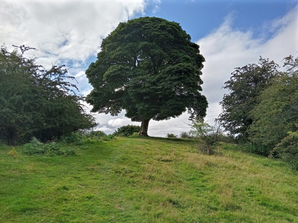
At the next waymark post continue straight ahead, passing though more hawthorn and make for the large tree on top of the hill. There are some great views along here.
Walk along the permissive path to the Triangulation Point before descending steeply in the direction of a church, passing an old bath to reach a gate which leads on to a tarmac lane. Turn left and then immediately right and walk down the hill.
Take the next road on the right (Flint Lane). Pass the Cross Green Cottages and, just after the road bends to the right you should bear left, just past Bromley Croft. Continue along this lane which becomes an unsurfaced farm track. Turn left at a waymarked stile with a fingerpost and follow the path down, keeping the field edge to your left. Go over the next stile and stone culvert and cross the field, bearing right, to go past the corner end of the bordering hedgerow and trees opposite. Ignore the stile near there, just continue diagonally across to reach the stile in the far corner of the field. Go over this stile and turn left for Darley Bridge.
Turn right over the bridge using the pavement on the left hand side. Just over the bridge, re-cross the road to Flatts Farm on your right. (You’ll see the pub ‘Square & Compass’ – just a bit further along the road to the left if you want to stop for some refreshments.)
Go through the first stone stile and follow the waymarked path straight ahead – running alongside the wall with farm buildings to your right. Keep the stone wall to your left, crossing several stiles. At the fourth stile, head diagonally across the field and go over a wooden stile. Ignore a path that runs off to the left, continue ahead, keeping the field edge and stream to your left. Go over another stile, through the bushes and trees and then cross the stream via a narrow footbridge (take care here, as it may be slippery and watch out for encroaching branches). Turn right and continue until you reach the riverbank.
Continue ahead keeping the railway embankment to your left. After passing through a stone squeeze stile, keep left (do not follow the riverbank). Cross over another couple of stiles and the riverbank comes back into view from your right. Follow the riverbank for a short distance and go over a stile in a metal fence, after which bear left, leaving the riverbank to walk alongside the railway embankment again. Ignore the overpass and underpass on the railway – continue ahead following the field edge. When you reach a concrete ladder stile on the left – go over it and cross the railway. Caution – watch out for trains.
Go over the next stile, turn right and go through some overgrown scrubland. You will then reach the busy main A6. Cross over at the pedestrian refuge and turn right. Walk down the road until you reach the Matlock sign and a bus stop. Turn left through the metal gate by the bus shelter. Go right and follow the paved path up Darley Bridge the hill leading between Arc Leisure Matlock and the houses of The Dimple. Continue following the path across the end of a cul-de-sac by a recycling point. Keep straight ahead along the path, crossing over the next road. The path here is called Sheriff Lane.
You will eventually reach a road called Hurds Hollow where you need to turn right. Walk downhill past the YHA premises along Dimple Road to reach the A6 at the bottom. Bear left here and follow the main road into Matlock centre to reach your starting point, by crossing the river bridge.